


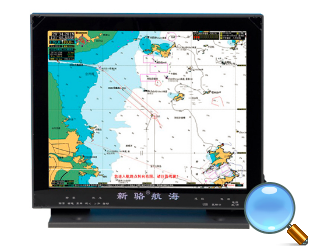
Xinluo GPS Chartplotter XINLUO-2118
Xinluo GPS Chartplotter XINLUO-2118
Product Details
Ÿ 17.1-inch high brightness LED display
Ÿ 1024*768 screen resolution
Ÿ Reliable quality
Ÿ The chart is detailed and the chart can be updated free of charge. There are also multi-regional foreign detailed charts available, please distinguish them at the time of purchase. Customized electronic charts for a specific area can be customized for customers.
Ÿ Support docking with multiple devices
Specification
GPS Receiving System | RX Frequency: 1575.42MHz; receiving mode: C/A code; positioning accuracy: <15 meters (RMS) Receiving channel: parallel 12 channels; speed accuracy: 0.2 knots or 2%; heading accuracy: ≤ ± 3 ° |
Display Unit | Model: XINLUO-21181280X1024 high brightness LED display |
Effective Size | 67E--143E, 0N--45N (professional chart range can be expanded) |
Resolution | Longitude, latitude, heading, speed, fishing area, time, date, number of satellites used. |
Reference Chart Range | Waypoint number, route number, name, coordinates, distance, direction. |
Ship Location Data | Flight line number, date, time. Track point coordinates, date, time. |
Route Data | Cursor point coordinates, distance, direction, fishing area. |
Track Data | Various navigation aids, lightning response, reefs, dangerous waters, shipwrecks, anchorages, prohibited areas, isobaths, place names, bridges, water depth standards. Fishing obstacles, fishing areas, forbidden lines, etc. |
Delete and Modify Function | It can modify all the points, ground objects and surface objects on the chart. And you can export, save and share. |
AIS Target Ship Display Data | Display the ship's nine-digit code (MMSI), name, call sign, position, heading, speed, ship's name, ship type, ship's position distance, and distance from the ship's parameters, etc. |
AIS Target Ship Application | Set the alarm to enter the warning zone; set the alarm of TCPA and DCPA; Schematic diagram of the target ship. |
System Text | Chinese Simplified or English menu |
Operation Method | With / wireless remote control keyboard, USB mouse |
Waypoint | Capacity: 8000 points, 8 shapes, 8 colors. |
Marking Point | Capacity: 10,000 points, 24 shapes, 8 colors. |
Track Record | Recording range: north latitude 85°-- south latitude 85° recording interval: 0.03 nm - 2 nm or 1S - 360S; recording capacity: 100000 points (basic type is 50,000 points), 8 colors. |
Planned Route | Capacity: 1000, there is no limit to the number of waypoints in each route. |
Alarm | Arrival; anchoring; yaw; automatic route rotation; AIS target ship electronic warning zone; maritime approved bridge alarm |
Power Supply | Use DC 18V to 40V or AC 110V to 220V. (Please pay attention to the model and socket signs) |
Power | 40W-80W (different models have different power consumption, please pay attention to the brand name) |
GPS Output Format | NMEA-0183. 4800bitRS-4224 Group Interface Output |
External GPS Input Format | NMEA-0183. 4800bitRS-422RS232 |
External AIS Input Format | NMEA-0183. 38400bitRS-422RS-232 |
Working Conditions | Ambient temperature: antenna unit -20℃--70℃; main unit and display unit-5℃--60℃ Relative humidity: 90% (at +40℃) Vibration: 2-5Hz up to 13Hz, ±1mm±10% |
HOME | NEWS | Product Center | Solution | Case Presentation | Service Centre | About us
Tianjin Ocean Telecom Technology Co., Ltd. Tel: 022-25859385 E-mail:tjhysm@126.com Address:5th Floor, No. 50A, Bohai Road, Economic and Technological Development Zone, Binhai New Area, Tianjin | 
天津大海电信科技有限公司 津ICP备13000197号 版权所有 技术支持:大海电信 |